Trail Maps
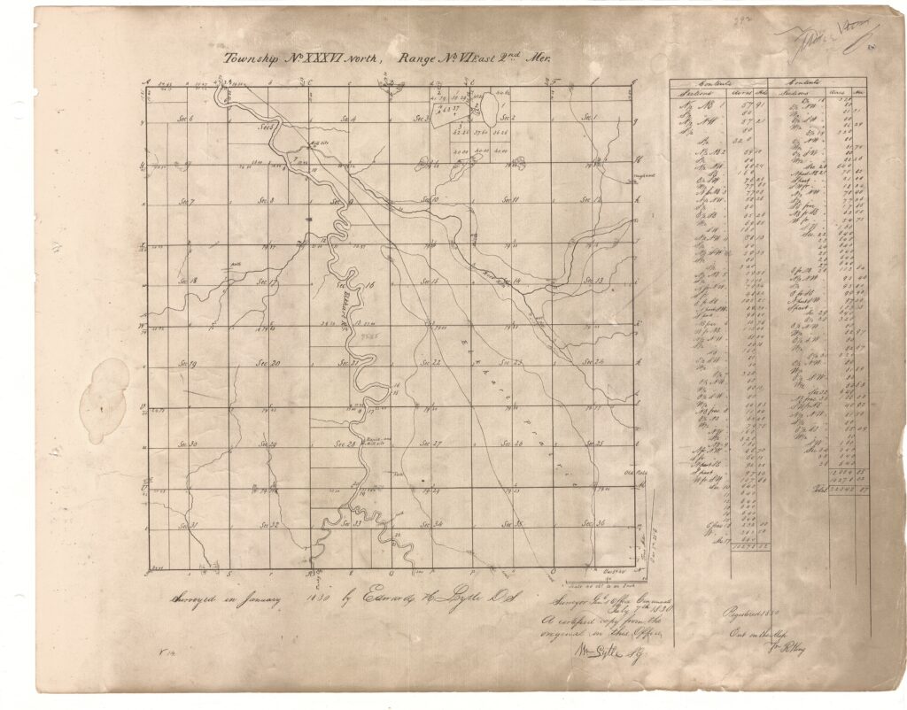
Much of the evidence for the trail location in Elkhart County, Indiana is based on the survey work done during 1829-1830 following the signing of the treaty with the Potawatomi in 1828. (For information on this treaty and the other treaties in northern Indiana, go to the Indigenous History pages.)The surveyors kept field journals as they laid out the county, township and section boundary lines. Cartographers developed maps from the data the surveyors collected. The Elkhart County Surveyor’s Office in Goshen, Indiana has copies of the original field journals and maps. The trails goes diagonally through the county from the southeast to the northwest.
The following is a quick sample of the maps that aid in determining where the Potawatomi-Miami Trail passed through Elkhart County.
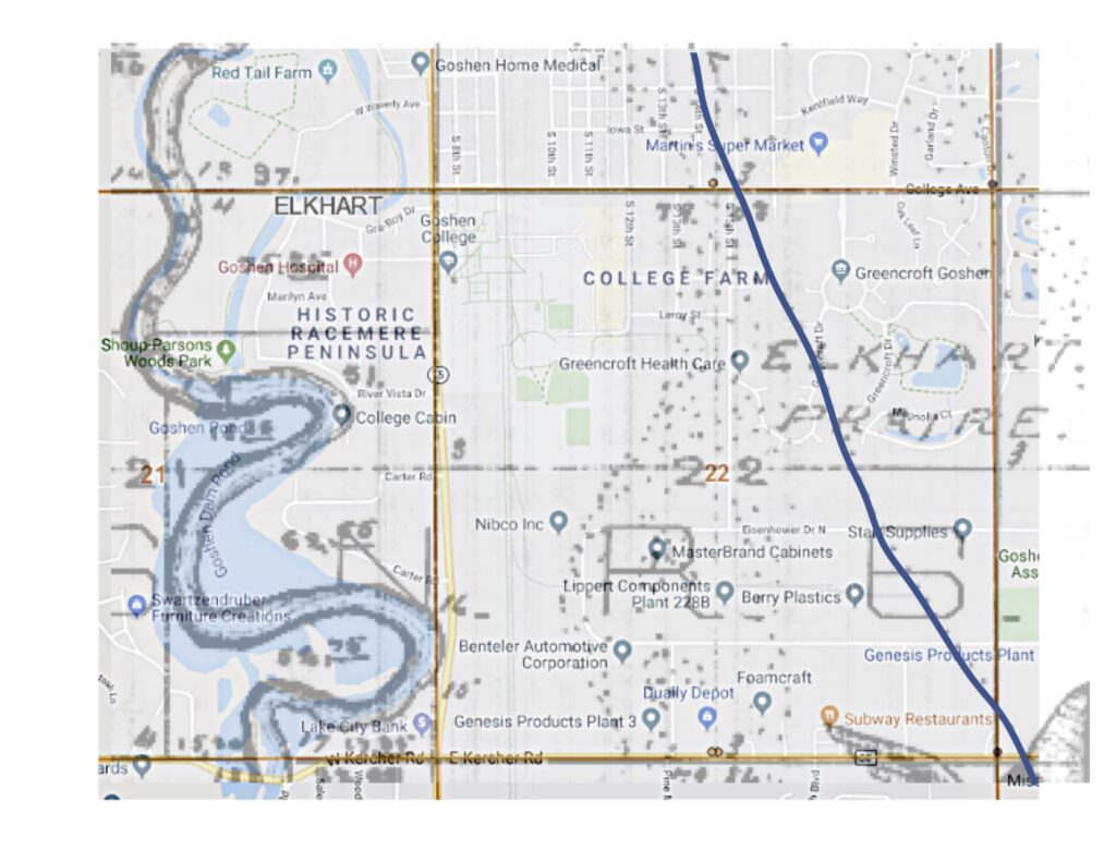
Maps have been made that show the 1830 maps with an overlay of current Geographical Information System (GIS) maps, which aid in knowing where the trail passed. The following are several examples of the overlay maps. More will be added as our work of marking the trail continues.