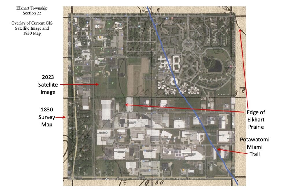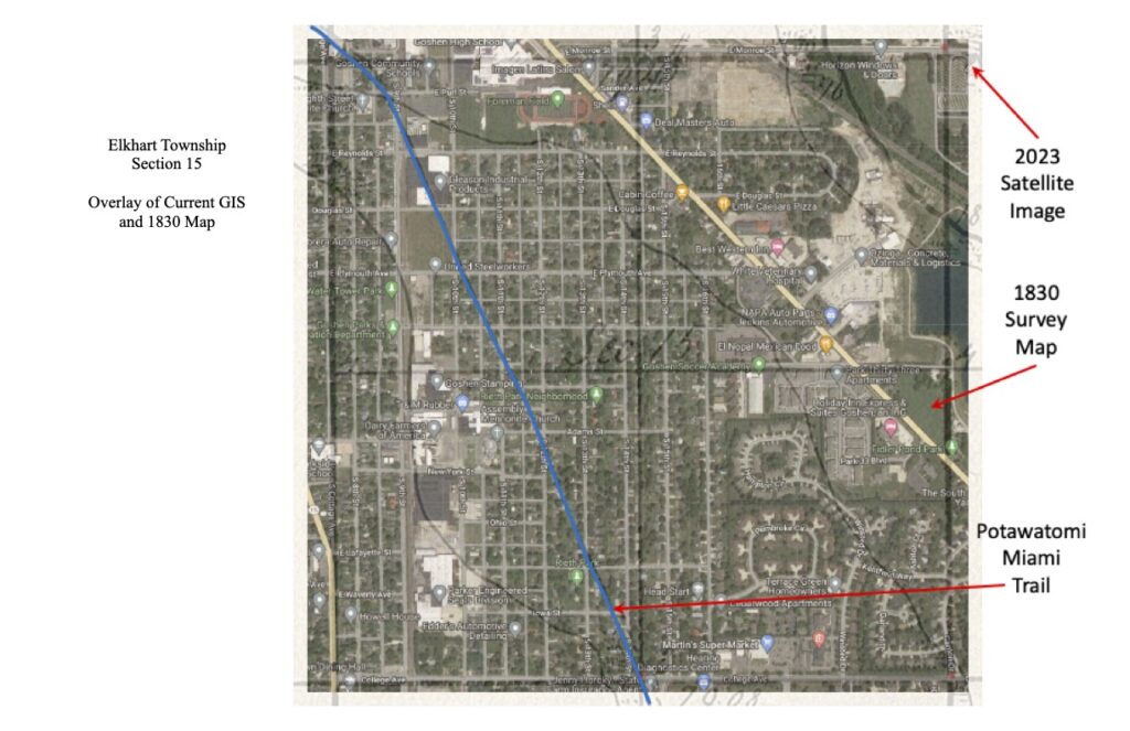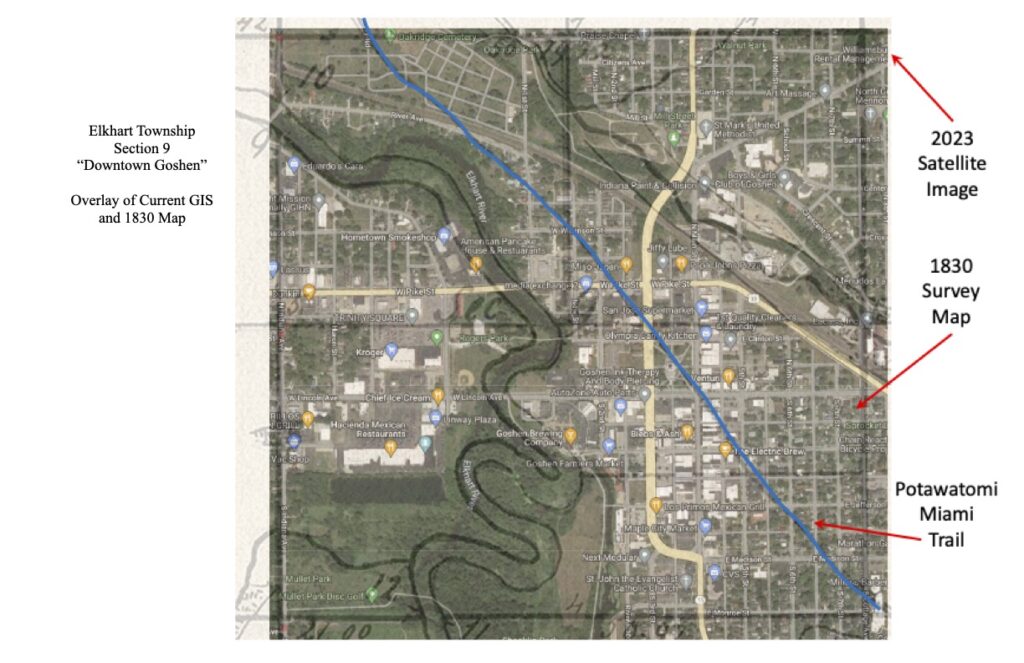
Elkhart Township Map
The map below is from 1830. The cartographers drew the map based on the surveyors’ data as they marked out all the sections.
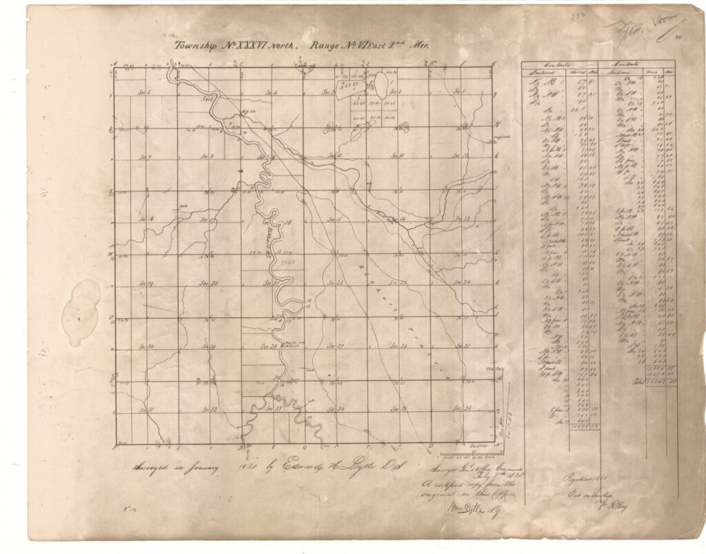
Each township contains numbered sections. A section is a one-mile by one-mile square. The 1830 surveyors recorded information about each section corner’s location. The sections are still numbered in the same way today and are used in the current Geographical Information System (GIS) found on the Elkhart County Surveyor’s Office website. The following maps are overlays of 1830 sections with the corresponding section from GIS. More overlay maps will be added as they are made.